|
The History of Lutz - Page 2
|
|
|
Read the left and right panes before scrolling down to the next levels. Click links to view related photos, use your back browser button to come back to this page. |
|
|
Click on links in text, they lead to more pictures |
|
|
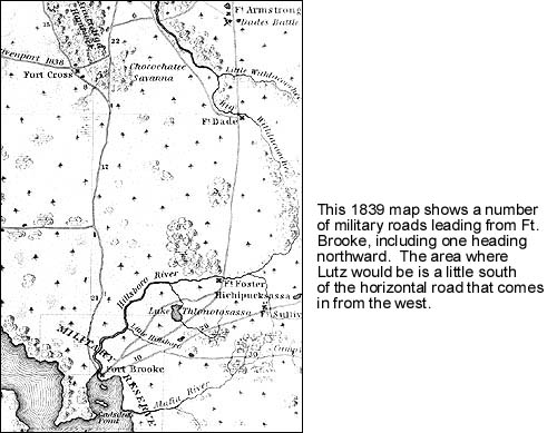
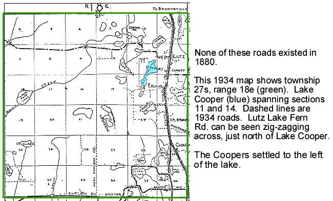
The earliest inhabitants of the Lutz area were Native Americans. Around the 16th Century the Spaniards arrived and found the area had an ample water supply, wild game and good areas to establish camp sites. White settlers started to move in around the early 1800's, due to some protection provided by Fort Brooke (present day Tampa.) 1839 Map
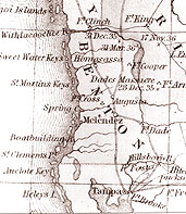
This 1850 map of Florida's west coast shows the entire area between Hillsborough County and Levy County was named Benton County, for U.S. Sen. Thomas Hart Benton. When he began to speak against slavery, the Florida Legislature changed the county name to Hernando.
|
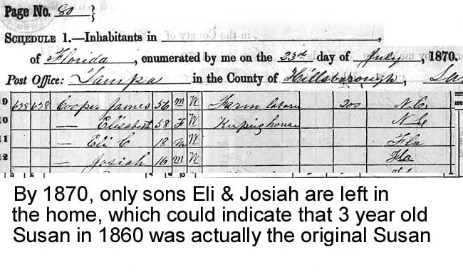
The 1850 census of Hillsborough County shows James Madison Cooper and wife Elizabeth who had settled on the west side of present day Lake Cooper in the 1830's. According to their censuses, they had children Mary Ann, Elizabeth, Amanda Ann, Sarah Ann, Rebecca Ann, Susan Ann, James M., Eli and Josiah. Their censuses are fraught with age discrepancies from census to census, which was taken every 10 years. The census images below have been pieced together in order to show only pertinent information and reduce the physical size and file size.
|
|
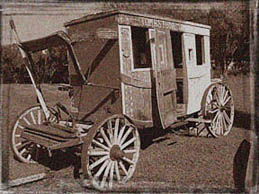
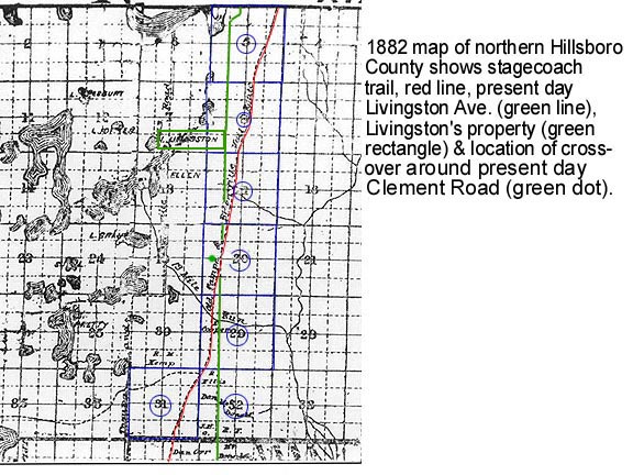
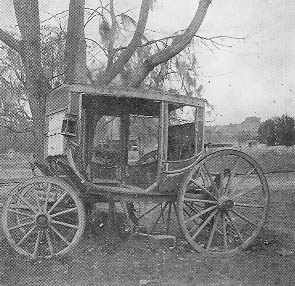
From the 1850's to around 1907, the Ocklawaha and the Concord Stagecoach Lines carried passengers & freight between Brooksville and Tampa. The Concord line cut through the center of now Pasco County. One rest stop (relay station) at Ehren near the well field was known as "26 Mile House" in the 1880's.
The coach stopped at the Myrtle P.O., north of present day Livingston Avenue and Denham-Dade Road (now Hwy. 54) where a fresh team of horses was put on. The route in Myrtle was known as Twenty Mile Level Road because it was 20 miles from Tampa and quite level! |
Henry Havlik recalls the coach running right by his place on present day Livingston Road, just north of the county line, which was first named Havlik Road.
The late Fred Burris described the stagecoach route as it headed north out of Tampa: North of Nebraska Avenue, the coach went to Nowatney near the intersection of now Skipper Road and Nebraska, then headed northeast winding around the lakes and swamps to keep on higher ground. It crossed Roaring Gully (now known as "Thirteen Mile Run") which is just south of present day Max Smith Road and Livingston Ave.) From there it headed north, still staying west of the big swamps (which back then were just east of present day Livingston Ave.) Near the edge of the timberland, pine needles improved traction in the sand. After the route crossed Havlik Road (the extension of Livingston into Pasco County) it went north to the Myrtle post office and on to Brooksville. |
|
|
|